Society

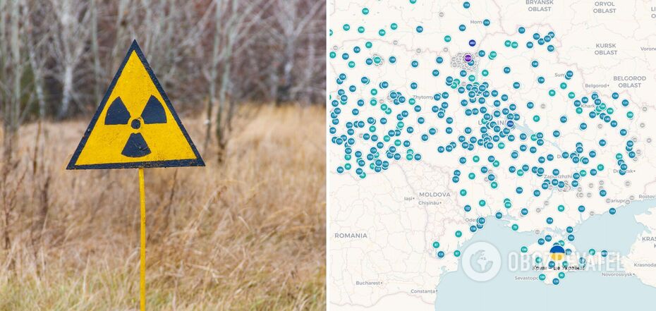
Details about the current radiation background and wind direction can be found in the online maps


Ukraine lives in anxious anticipation because of a social media post about a possible terrorist attack by the Russians at the Zaporizhzhia nuclear power plant. The fact that the plant was mined was also previously confirmed by the Ukrainian Defense Ministry and Military Intelligence. This anxiety can be somewhat dispelled with up-to-date information about the current radiation background and wind direction.
OBOZREVATEL collected a link to current maps that will help navigate the situation. They show what is happening with radiation levels in our country, and where the air masses will move in case of an accident.
What is disturbing
Recently, information concerning the preparation of a "provocation" by the Ukrainian Armed Forces at the Zaporizhzhia NPP appeared in Russian anonymous telegram channels. Given the typical practice of Russian occupants to shift responsibility for their crimes, Ukrainians began to speculate that this might be a kind of announcement of a terrorist attack by the Russian Federation.
Citizens of our country immediately began to search the Internet for all the necessary information. In particular, about the response measures in case of a nuclear catastrophe and the current situation in real time.
What the scale of the catastrophe may look like
According to experts, the populated localities in the 30-kilometer zone around the nuclear facility will be in the greatest danger from an explosion of the ZNPP. An urgent evacuation will be announced from there. In particular, Kamianka-Dniprovska, Kushuhum, Malokaterynivka, Balabyne, Balky, Vasylivka, Velyka and Mala Bilozerka, Dniprorudne and Mykhailivka will suffer in Zaporizhzhia region. Towns and villages in the Dnipropetrovsk region like Nikopol, Marganets, Pokrovske, Chervonohryhorivka, Hrushevka, Tomakivka and Pokrovka will be also affected.
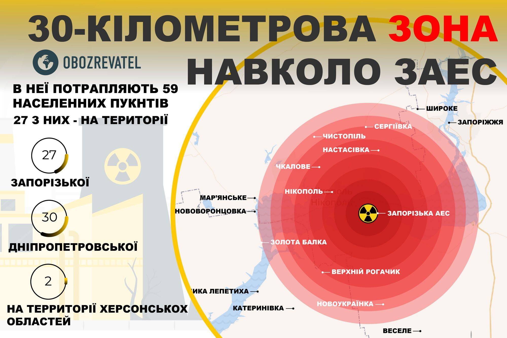
This is what a map of the likely exclusion zone that could result from a ZNPP explosion looks like. The further spread of contamination will not least depend on the direction of the winds that carry the cloud of emissions. Experts estimate that it will cover other territories besides Ukraine as well.
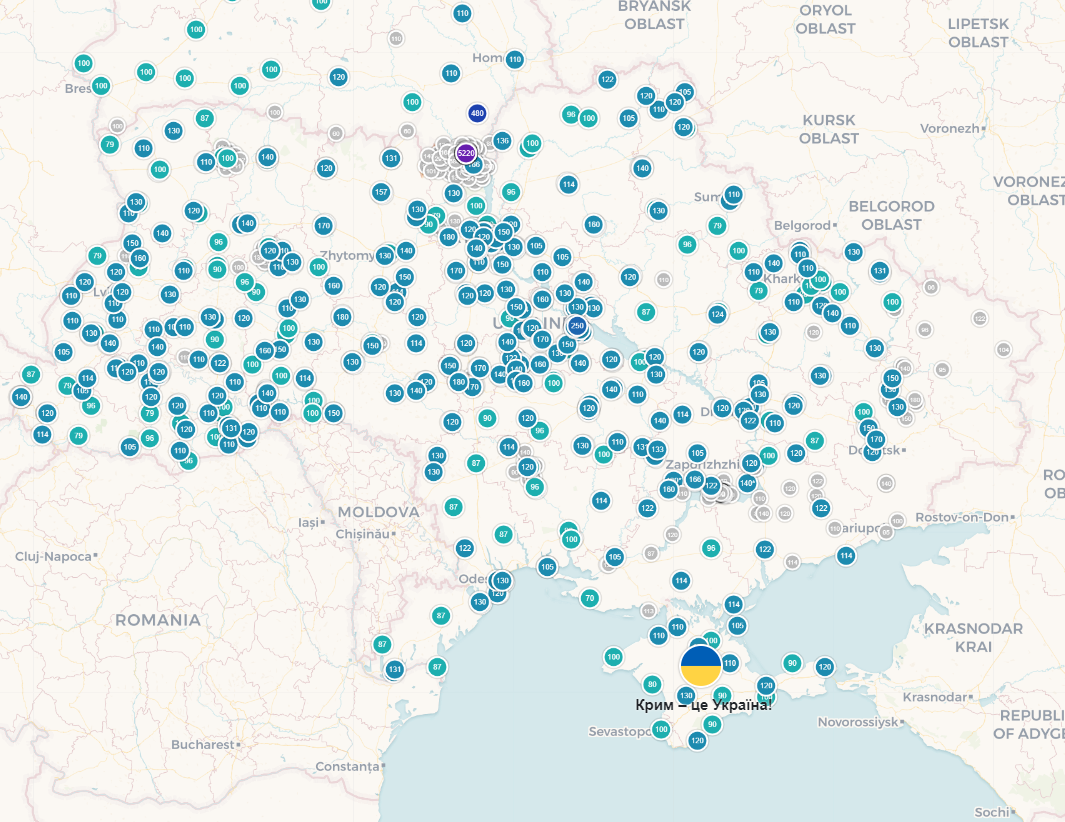
Where to find the current radiation background
To track the radiation background in Ukraine, a special online map was launched by the developers of the SaveEcoBot service. It started working last year, when the occupants entrenched themselves in the Chernobyl zone and seized the Chernobyl NPP. The service shows the current results of measurements at the stations located throughout the state.
You can pull up information about wind direction with the help of layers. The most recent data of the frontines is also shown. The data is collected both automatically and manually and comes from the most dangerous points in Ukraine.
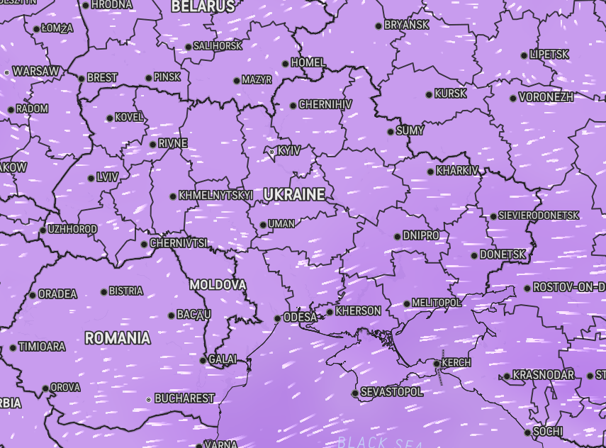
Where to find out wind direction
Some weather services provide accurate wind direction data. In particular, there is a map on the AccuWeather website. The movement of air masses is displayed with the help of animation, so its data will be clear even for an inexperienced user.
Recall, OBOZREVATEL published recommendations of the Ministry of Health on actions in the event of a nuclear accident and on preparation of an emergency suitcase.
Subscribe to OBOZREVATEL channels in Telegram and Viber to keep up with the latest developments.
Other News


The long-awaited VW crossover cheaper than Duster was shown in photos
The Tera is being prepared for the premiere

How to boil beets in 10 minutes: an elementary method that will suit everyone
You don't even have to turn on the stove


Delicious and healthy "Napoleon" made from phyllo dough: it takes a few minutes to prepare
The easiest way to make a popular dessert

The most fashionable manicure color for spring 2025: five periwinkle designs
Spring 2025 brings a new color favorite in the world of manicure