News
A mysterious giant "scar" was spotted on Google Earth photos in Australia. Photo
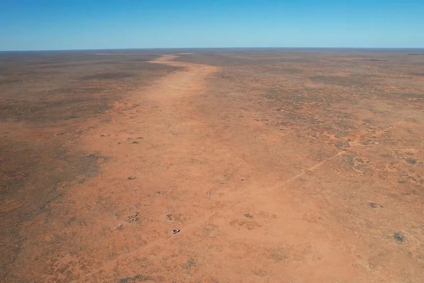
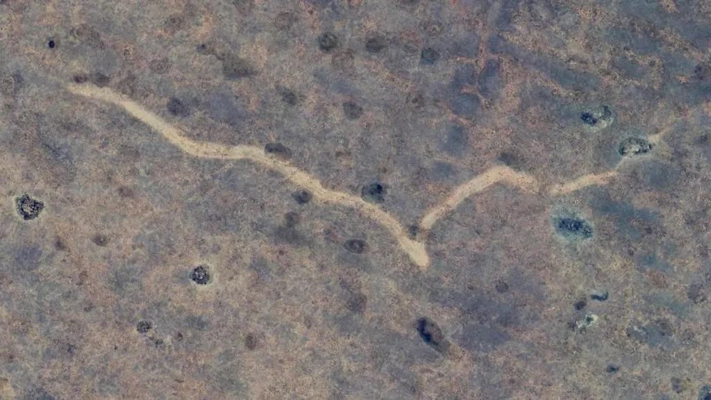
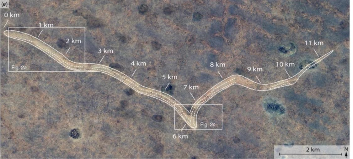
A spelunker studying Google Earth satellite images has discovered a huge "scar" 11 kilometers long. This giant crack is located in the barren landscape of Nullarbor in Australia.
This discovery interested other scientists. After a more detailed study, they found that the scar was formed by a fierce tornado that no one knew about, Live Science reports.
The man was looking for a cave but instead noticed a mysterious figure on the ground. It looked like a long, thin line stretching mostly from east to west. The sign was not completely straight – it was sloping and curved, and at one point it formed a deep V.
Eventually, news of the mysterious discovery reached researchers at Curtin University in Perth. After studying historical satellite imagery and weather data for the region, they realized that unusual waves on the ground are a hallmark of tornadoes, Smithsonian Magazine writes.
"Without the power of technology, this amazing example of nature's cruelty would have gone unnoticed," said one of the study's authors, geologist Matej Lipar, a geologist at the University of Curtin.
Lipár and his colleagues determined that the tornado passed through the area sometime between November 16 and 18, 2022. During this period, the region experienced a low pressure system and a cold front, which could have caused severe weather conditions.
Scar stretches from Western Australia across the border into South Australia. It is located 20 km north of the Trans-Australian Railway and 90 km northeast of Forrest, a former railroad settlement.
The scientists then visited the site to examine and photograph the scar and the surrounding landscape. The results were published in the Journal of Southern Hemisphere Earth Systems Science.
The scar is 11 kilometers long and 160 to 250 meters wide. It has amazing patterns called "cycloidal marks" formed by tornado vortices. This indicates that the tornado was not an ordinary storm, but a strong category F2 or F3 storm rotating with destructive winds of more than 200 kilometers per hour.
Only three tornadoes have been documented in the Nallarbor Plain in the past. This is probably due to the fact that the area is remote, with few eyewitnesses, and because the events do not cause damage to property and infrastructure.
Only verified information is available on the OBOZ.UA Telegram channel and Viber. Do not fall for fakes!


