News
Traces of fire can be seen: satellite images of the aftermath of a DIU strike on a radar in Russia 1800 km from the border have been released

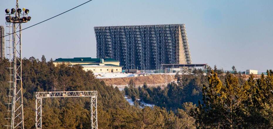
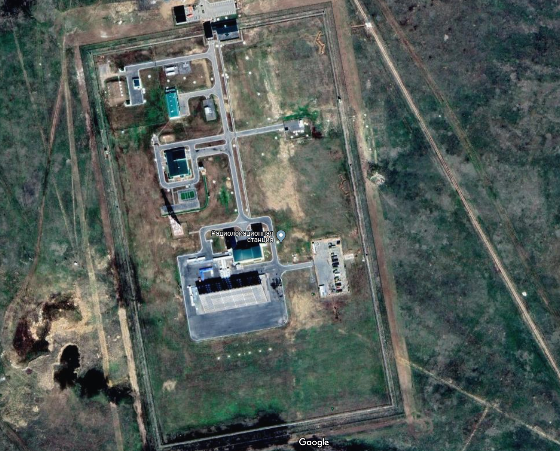
Radar "Voronezh". Source: rosmedia


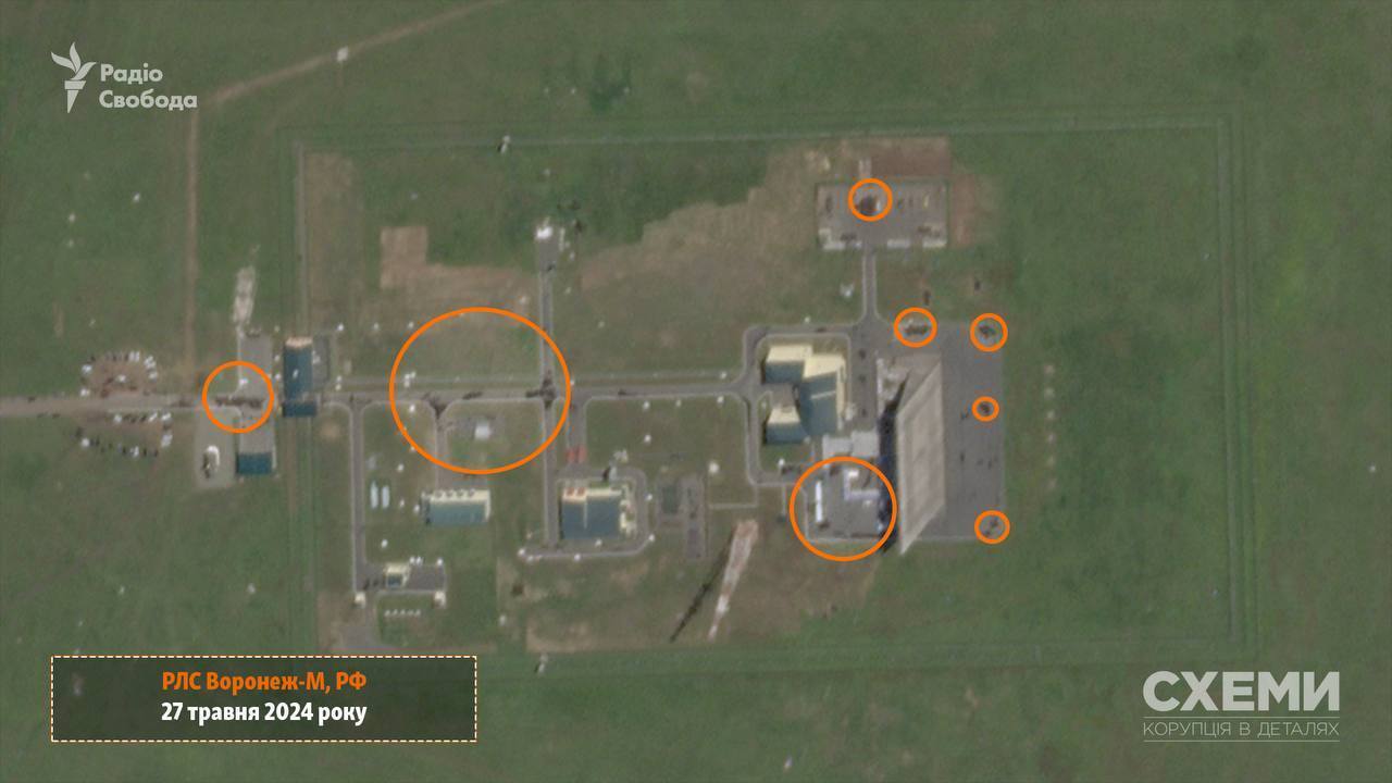
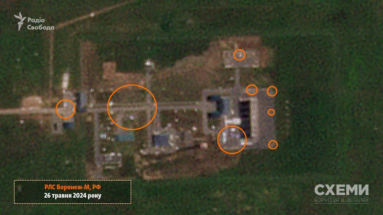
Satellite images showing the aftermath of the attack on the "Voronezh M" long-range target detection radar station in Orsk, Orenburg region, have been published online. Traces of fire were recorded on the territory of the enemy military facility.
The resolution of the satellite images does not allow to assess the extent of possible damage to the Russian station. This was reported by the Schemes Telegram channel.
The Planet Labs satellite recorded the consequences of a drone attack on a strategically important enemy facility. The photo from May 27 shows that dark spots appeared on the territory of the radar station, probably traces of a fire caused by a UAV hit.
However, it is worth noting that the low resolution of the photo does not allow us to assess the extent of possible damage to the "Voronezh M" radar. In addition, as of 13:30 on May 27, no official comment has been made on the drone damage to the radar in Ukraine or Russia.
Only local propagandists in Orenburg confirmed that Ukrainian UAVs had flown to Orsk and attacked military facilities. At the same time, the Russian Federation claims that no damage was allegedly recorded.
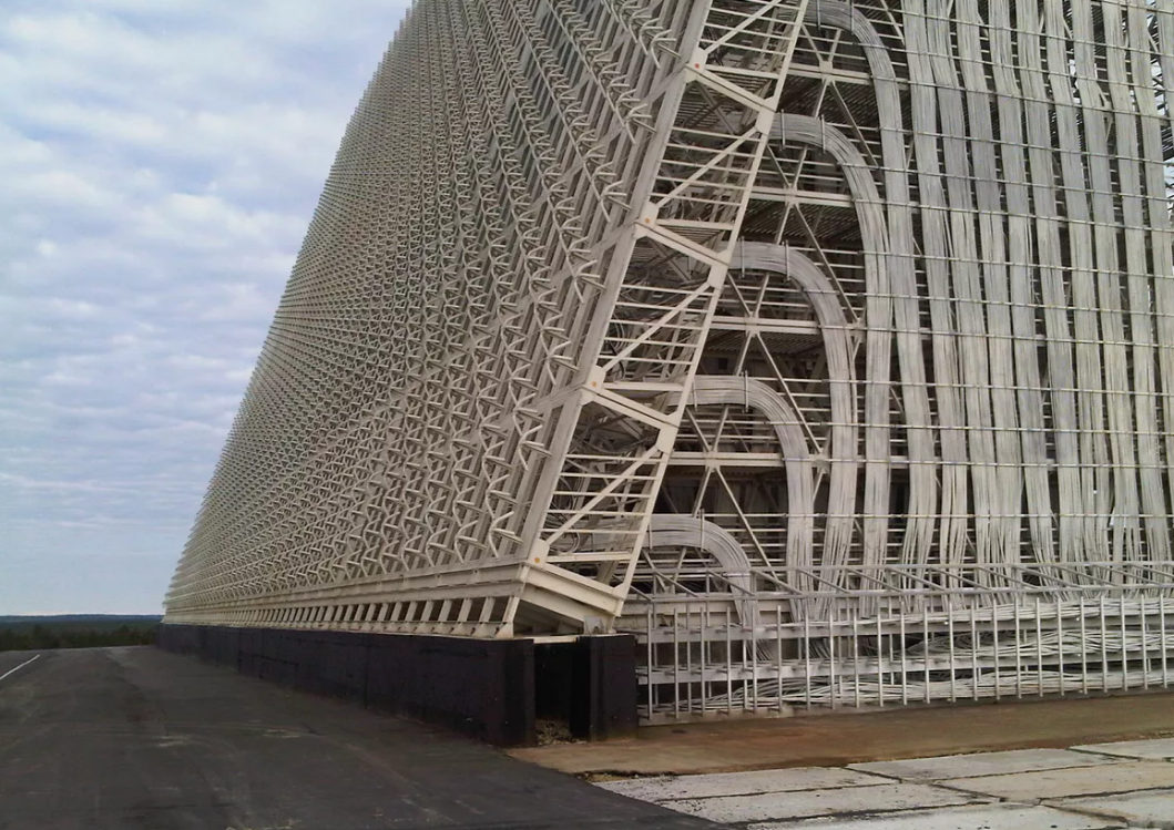
The "Voronezh" long-range over-the-horizon radar station is designed to detect space and aerodynamic objects, including ballistic and cruise missiles. The family consists of stations of the meter ("Voronezh-M", "Voronezh-VP"), decimeter ("Voronezh-DM"), and centimeter ("Voronezh-CM") wave bands.
The "Voronezh M" station in the Orenburg region can detect targets at a distance of up to 6000 km. The Russian Federation claims that this particular radar controls the sector from the Takla Makan Desert (China) to the shores of the Mediterranean Sea. Since 2015, it has been operating in a test mode to track ballistic targets, and in 2017 it was put into operation.
As a reminder, Ukrainian drones attacked a radar station on the territory of the aggressor country Russia. It is noteworthy that the object was hit with a distance of more than 1800 km. It was a "Voronezh M" long-range target detection radar.
Earlier it was reported that in Russia on the night of May 27, unknown drones attacked a fuel station in Livny, Oryol region. While the fire was being extinguished, another UAV crashed on the territory and caused a casualty.
Only verified information is available on the OBOZ.UA Telegram channel and Viber. Do not fall for fakes!
Other News


"I'm not trying to mock": former world champion spoke humiliatingly about Usyk
The Briton spoke about the success of our compatriot

How to get rid of mold and odor in the washing machine: an effective method
These products are always at hand


Healthy beetroot salad with eggs and cheese: tastier than "Shuba" and "Vinegret"
Preparing a dish without mayonnaise

Cherry McPie at home in seconds: it will be tastier than in a restaurant
It is worth trying to cook yourself