News
The area of hostilities in the Kursk region is growing: Russia shows a new map
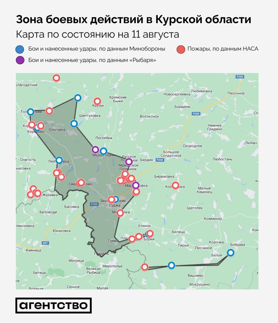
On August 11, fighting continued in the Kursk region of Russia. The area of the territory that was not under the control of the Russian Armed Forces increased to at least 720 square kilometers, which is 70 square kilometers more than the day before.
These calculations were published by the Agency. The project took into account reports from the aggressor country's Ministry of Defense, Russian military propagandists, and data on fires from NASA satellites.
It is stated that in the Suzhansky district, military operations were conducted in approximately the same area as on August 10.
The Russian authorities recognized that the soldiers (claimed to be Ukrainian) raided the neighboring Bilivskyi district.
The farthest point from the border where the fighting took place is the village of Obschiy Kolodez in Korenivka district (28 km from the border, only 9 km from the Lgov-Rylsk road).
The westernmost point where the fighting took place was near the village of Tolpino. The Russian Defense Ministry claims that "enemy mobile groups on armored vehicles" were spotted there.
The easternmost point of fighting is the village of Martynivka. The southern border of the clashes is located somewhere in the Bilivskyi district, where the soldiers raided deep into Russian territory. Previously, they crossed the border near the village of Kucherov.
As reported by OBOZ.UA:
– Russia is panicking because of the operation in the Kursk region. On propaganda shows, there are statements that these events are an "invasion" rather than a "penetration into the DRG area" because the military (allegedly Ukrainian) used significant forces and means.
– The authorities of the aggressor state announced a "counterterrorist operation" in the Belgorod, Bryansk, and Kursk regions.
– As of August 10, more than 76,000 Russians have been evacuated from the Kursk region.
Only verified information is available on the OBOZ.UA Telegram channel and Viber. Do not fall for fakes!


