News
Kherson in the nineteenth century: the first known photos of the city
People have lived on the site of the modern Ukrainian city of Kherson since pre-Christian times. However, it was granted the status of a city with its current name in 1778. Since then, its appearance has been constantly changing, as recorded in old photographs.
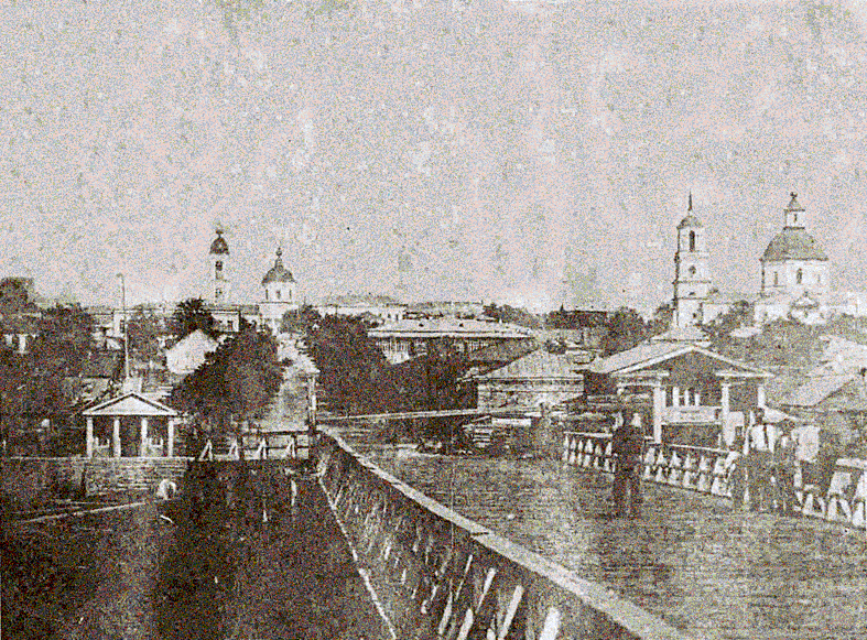
According to the regional publication "Most," the oldest known photographs of Kherson appear in the collection "Works of the Kherson Provincial Statistical Committee," published in 1863. The photos were pasted into the publication and now give an idea of what the city was like in the mid-19th century.
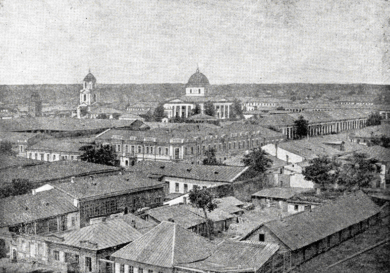
This photo was taken from the river's wooden pier on Rishelievska Street towards the city. The Old Believer's Church of the Intercession of the Virgin is visible in the background. To the right of it, you can see the Assumption Cathedral. The architecture of the city is strongly influenced by classicism.
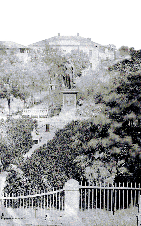
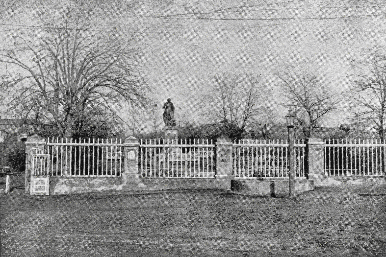
The next photo captures Potemkin Boulevard with the Potemkin monument. At the time, the building was only 27 years old. The theater building had not yet been built. Similarly, the building of the provincial zemstvo administration, where the polyclinic of Maternity Hospital No. 1 is now located, did not exist.
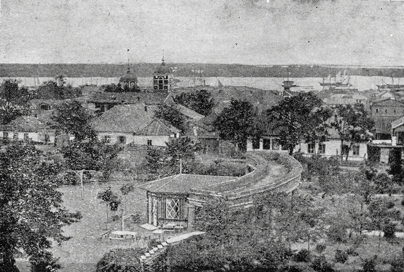
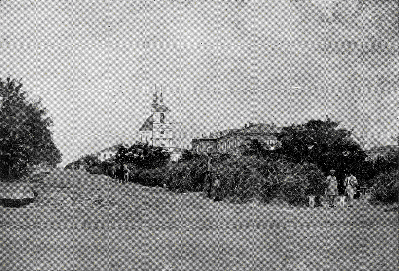
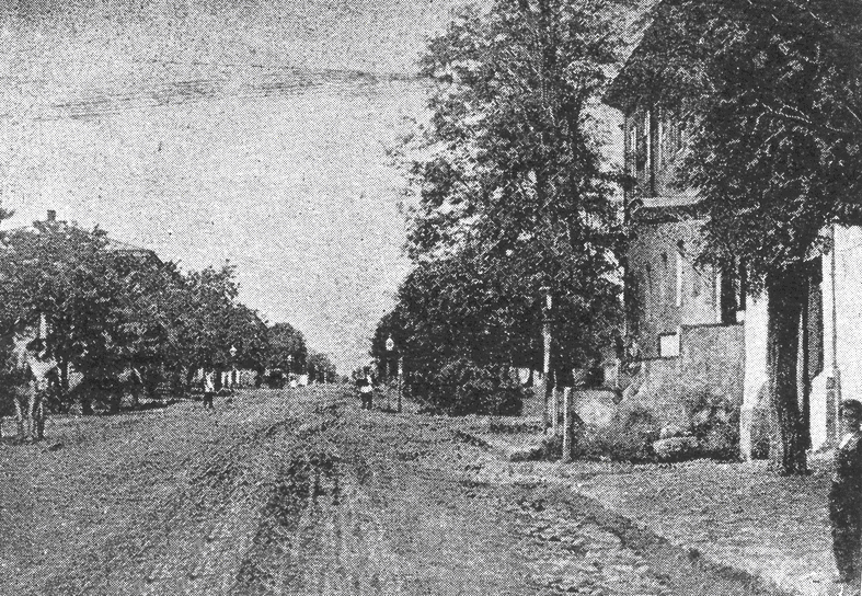
The next known series of photographs of old Kherson is a selection of five images from the 60s and 70s of the nineteenth century. These images were published by Serhii Silvanskyi in his 1928 book "Old Kherson. I. Greek suburb." He captured the rotunda in Pavlivskyi Park, the architectural ensemble of Soborna Street, Potemkinska Street with Gymnasium Boulevard, Potemkinskyi Boulevard, and Pryvizna Square.
The photo of Pavlivskyi Park shows a rotunda, a colonnade like the one you can see near the Vorontsov Palace in Odesa. It was located right on the site of the current building of the Museum of Local Lore (Ring Court). In the background, you can see the wooden bell tower and dome of the Old Believer Church of the Nativity of the Virgin Mary.
The image "Soborna Street. City Assembly. Cathedral" shows the area from the Museum of Local Lore towards the Assumption Cathedral. In the center of the frame we see the cathedral, on the right is the building that, after several reconstructions, turned into the current Palace of Culture of Shipbuilders.
For some reason, the shot of Potemkinska Street and Gymnasium Boulevard does not show a slope toward the Dnipro. This is probably due to the angle of the shot.
The photo of Potemkin Boulevard again shows the Potemkin monument, but probably in the days of early spring.
The last photo shows Pryvizna Square. This photo was taken from the bell tower of the Intercession Church. Nowadays, it is replaced by a sculpture of the Intercession of the Virgin Mary in the park behind the registry office. In the center is the Church of the Holy Spirit, which is still square in plan. It was not until the early twentieth century that it was expanded with the so-called "refectory." In front of the church stands the bell tower, which is actually the Church of the Transfiguration, which gave the street its name. The bell tower was destroyed during the Second World War. To the left of it is a water tower. The space of the Pryvoz market barely fits into the frame. You can see the shopping aisles on the right side of the picture.
Subscribe to the OBOZ.UA channels on Telegram and Viber to keep up with the latest events.


