Life

NASA publishes first full Earth image taken by NOAA-21 satellite


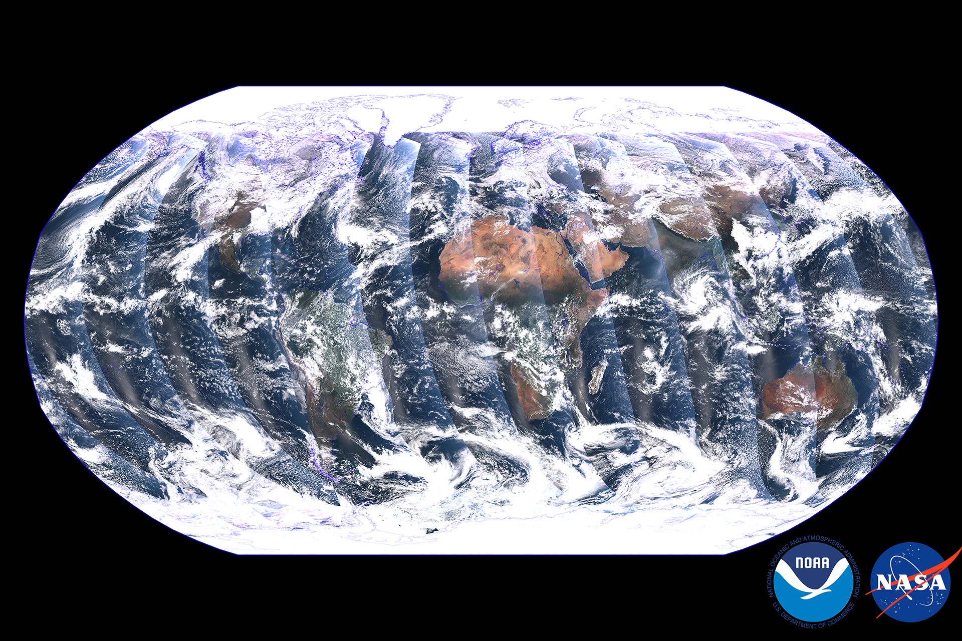
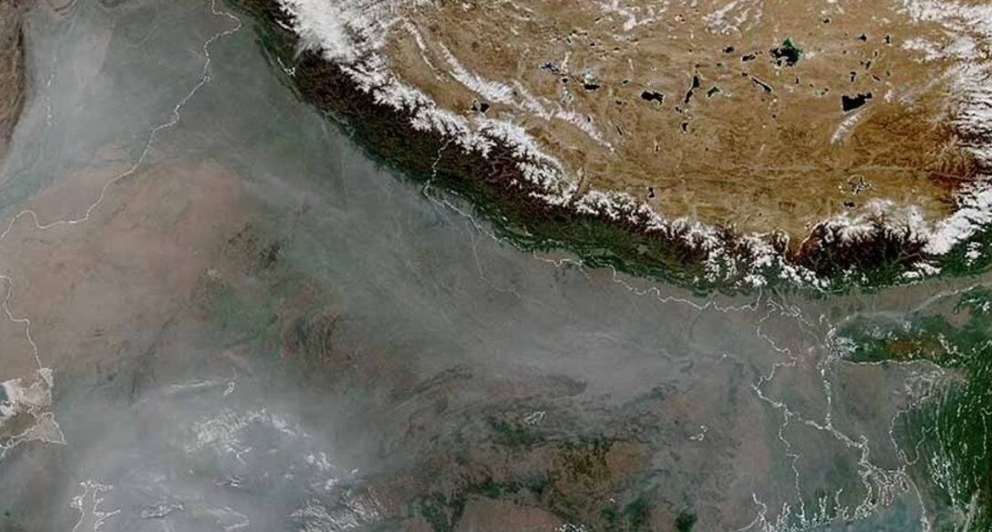
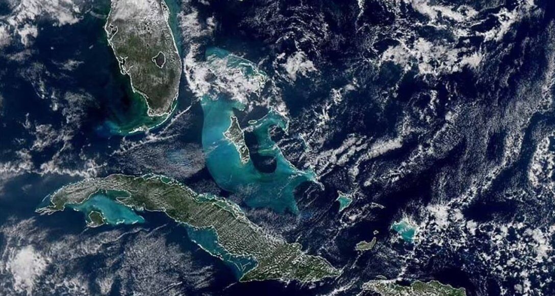
A new NASA space satellite called NOAA-21, which was launched in November 2022, has taken a global image of the Earth. It shows in detail the waters of the Caribbean Sea, as well as agricultural fires in Northern India.
This was reported on space.com. As noted, the images of the Earth that make up this mosaic and several close-ups were obtained on 5 and 6 December using an instrument called the Visible Infrared Imaging Radiometer Suite (VIIRS) aboard NOAA-21.
The satellite itself was launched into space on November 10, 2022, from the Vandenberg Cosmodrome.
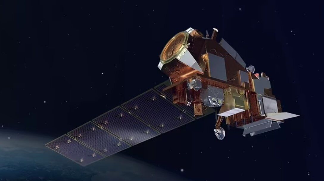
As noted, VIIRS collects images in both visible and infrared light spectra, allowing scientists to see details of the Earth's surface. This device provides specialists with important information about the planet's oceans, atmosphere and land. It can detect differences in ocean colour, telling scientists where phytoplankton is located or whether a dangerous algal bloom has formed along human-inhabited shores.
The instrument's atmospheric data can help scientists predict and track the movement of storms.
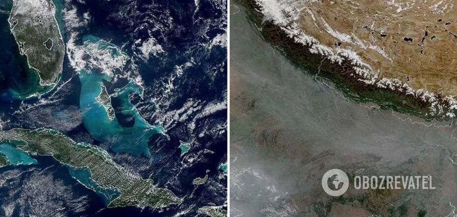
For example, NASA has shown what the snow-covered Himalayas and Tibetan plateau look like, and the smog hanging in the air over Northern India was also captured - it was caused by the burning of crops.
In addition, it shows a stunning view of the Caribbean Sea, with Cuba and the Bahamas also visible.
As reported by OBOZREVATEL, researchers from University College London believe that a planet on which life could exist orbits a dying star 117 light years from Earth.
Only verified information is available on our Obozrevatel Telegram channel and Viber. Do not fall for fakes!
Other News


They are back on their honeymoon: Meghan Markle tells how she made Prince Harry fall in love with her again after seven years of marriage
The spark has not yet faded between the spouses

"There is no such thing as overweight": Yevhen Klopotenko describes the ideal woman for him and explains why he doesn't pay attention to appearance
Personal traits of a partner are important for a restaurateur


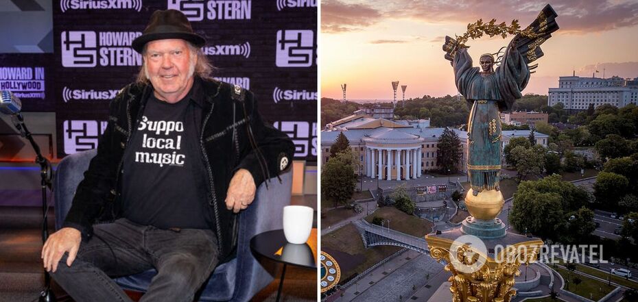
Rock legend Neil Young has announced a free concert in Ukraine
Negotiations on the organization of the concert are underway
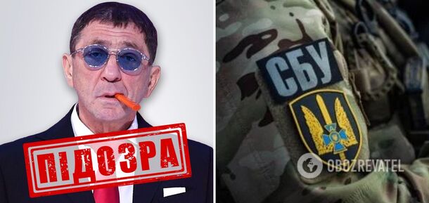
He promised a "fee" for destroyed tanks of the Armed Forces of Ukraine: Grigory Leps received a suspicion from the SSU in absentia
In 2023, the artist traveled to occupied Donetsk